

Wind, Solar Photovoltaic, Collocated Geothermal, Concentrating Solar Power, and Biomass
(US Department of Energy, NREL; map descriptions courtesy Tom Acker)
-
Photos obtained from the gallery below are to be used for lawful purposes only. Any commercial use must receive prior approval from the Arizona Solar Center. Credit shall be given to photographer along with Arizona Solar Center, and no affiliation with Arizona Solar Center is to be implied.
 |
Solar Photovoltaic ResourceThe solar photovoltaic resource maps provides average daily total solar resource information on grid cells of approximately 40 km by 40 km in size. The insolation values represent the resource available to a flat-plate collector, such as a photovoltaic panel, oriented due south at an angle from horizontal equal to the latitude of the collector location. |
|
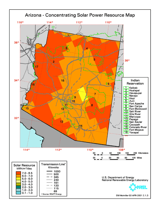
Concentrating Solar Power ResourceThe concentrating solar power resource maps provide monthly average daily total solar resource information on grid cells of approximately 40 km by 40 km in size. The insolation values represent the resource available to concentrating systems that track the sun throughout the day. Such systems include concentrating solar power systems such as trough collectors or dishes.Because the resource data are for a tracking system, the available resource tends to be higher than for non-tracking systems in sunny areas, but lower in cloudy areas, because under cloudy conditions tracking systems are unable to use any of the solar resource, which is obscured, whereas flat-plate collectors can still make use of the available sky radiation. |
 |
Biomass ResourcesThe biomass resource maps show county-level estimates of biomass resources available for biofuels production or biomass power stations. The map includes only the resources available from crop and forest residues. They do not include managed crop or forest resources, urban residues, municipal solid waste (MSW), or landfill gas (LFG). |
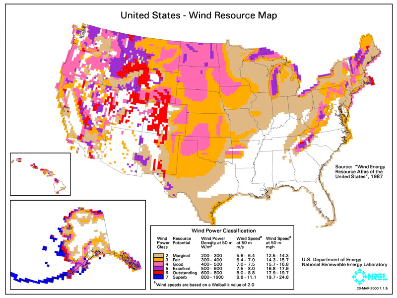
Wind Resources (AZ and United States) |
|
     |
|
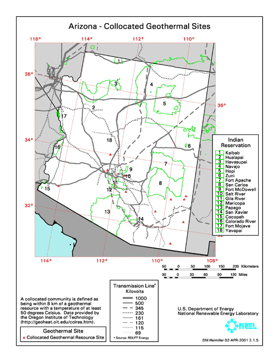 |
Collocated Geothermal |
US Solar Radiation Maps |
|
 |
This map, courtesy of the National Renewable Energy Lab (NREL), shows the average daily solar radiation (in Watt-hours per square inch) that falls on the United States. |
 |
Click here to view US Photovoltaic Solar Resource map... |
